CHESAPEAKE BAY - VIRGINIA COASTAL PHOTOGRAPHY
More charts can be found on the NOS Map Finder web site:
http://mapfinder.nos.noaa.gov/

There is overlap between these sections. Many photos are listed in more than one section. I have added a few annotations to better identify the photos. If you can provide annotations for any photos please send them to me at dan@pfeiffer.net. Thanks, DHP.

Clicking on a photo ID link will open the photo in a new browser window. Clicking on another photo ID link will will open that photo in the browser window of the previous photo. This way you can set the browser windows (index and photo) side-by-side for easier viewing.

The photos are GIF files about 900x900 pixels and about 500-800 kb in size. Scales vary as noted in the table. Resolution is 100 dpi from a 9x9" film. Photos with a scale of 40,000 cover an area about 5.5 miles square at about 150 pixels/mile. North is not always at the top of the photo. Most Photos are oriented so north is at top (roughly), some are not. I think the "Azimuth" column represents the bearing of the sun from the aircraft when the photo was taken (important to air photo interpreters). The coordinates given for the photo appear to be for the center but I have found some where the coordinates are not even a point within the photo.

See this page on the NOS web site for a description of the coastal air photos: http://oceanservice.noaa.gov/mapfinder/products/photos/welcome.html


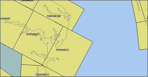
Great Wicomico
Image ID Comment Year Scale Azimuth Latitude Longitude
5WH44335 1992 50000 004.0 37.743 -76.321
5WH44337 1992 50000 004.0 37.819 -76.315
5WH44339 1992 50000 003.6 37.896 -76.308
5WH44347 1992 50000 120.6 37.922 -76.367
5WH44349 1992 50000 120.4 37.884 -76.286
5WH44351 1992 50000 298.0 37.803 -76.259
5WH44353 1992 50000 298.0 37.841 -76.349
5WH44355 1992 50000 298.2 37.878 -76.439

Great Wicomico river to Windmill Pt
Image ID Comment Year Scale Azimuth Latitude Longitude
5WFR3177 1991 50000 351.4 37.569 -76.529
5WFR3179 1991 50000 178.8 37.659 -76.449
5WFR3181 1991 50000 180.4 37.624 -76.447
5WFR3183 1991 50000 168.9 37.567 -76.439
5WFR3205 1991 50000 352.1 37.566 -76.326
5WH44305 1992 50000 137.4 37.697 -76.595
5WH44307 1992 50000 137.6 37.636 -76.524
5WH44309 1992 50000 305.3 37.626 -76.324
5WH44311 1992 50000 305.7 37.669 -76.402
5WH44313 1992 50000 305.5 37.713 -76.479
5WH44315 1992 50000 305.7 37.756 -76.556
5WH44325 1992 50000 110.1 37.623 -76.516
5WH44327 1992 50000 109.9 37.597 -76.428
5WH44329 Piankatank entrance 1992 50000 109.9 37.571 -76.339
5WH44331 Mouth of Rappahanock R. (E is up) 1992 50000 003.6 37.591 -76.333
5WH44333 Fleets Bay, Antipoison Cr., Tabbs Cr., Dymer Cr., Indian Cr. (E is up) 1992 50000 003.6 37.667 -76.327
5WH44335 Dividing Cr., Hughlett Pt., Ball Cr., Mill Cr. (E is up) 1992 50000 004.0 37.743 -76.321
5WH44337 1992 50000 004.0 37.819 -76.315
5WH44339 1992 50000 003.6 37.896 -76.308
5WH44349 1992 50000 120.4 37.884 -76.286
5WH44351 1992 50000 298.0 37.803 -76.259
5WH44353 1992 50000 298.0 37.841 -76.349
5WH44355 1992 50000 298.2 37.878 -76.439
5WK46626 1993 20000 087.6 37.662 -76.376
5WK46628 1993 20000 108.0 37.661 -76.343
5WK46630 1993 20000 100.5 37.653 -76.316
5WK46632 1993 20000 115.8 37.649 -76.282

Rappahanock River, Fishing Bay
Image ID Comment Year Scale Azimuth Latitude Longitude
5WK46626 1993 20000 087.6 37.662 -76.376
5WK46628 1993 20000 108.0 37.661 -76.343
5WK46630 1993 20000 100.5 37.653 -76.316
5WK46632 1993 20000 115.8 37.649 -76.282
5WFR3175 1991 50000 351.4 37.514 -76.518
5WFR3177 1991 50000 351.4 37.569 -76.529
5WFR3179 1991 50000 178.8 37.659 -76.449
5WFR3181 1991 50000 180.4 37.624 -76.447
5WFR3183 1991 50000 168.9 37.567 -76.439
5WFR3203 1991 50000 351.8 37.509 -76.315
5WFR3205 1991 50000 352.1 37.566 -76.326
5WH44305 1992 50000 137.4 37.697 -76.595
5WH44307 1992 50000 137.6 37.636 -76.524
5WH44309 1992 50000 305.3 37.626 -76.324
5WH44311 1992 50000 305.7 37.669 -76.402
5WH44313 1992 50000 305.5 37.713 -76.479
5WH44315 1992 50000 305.7 37.756 -76.556
5WH44323 1992 50000 110.0 37.648 -76.605
5WH44325 1992 50000 110.1 37.623 -76.516
5WH44327 1992 50000 109.9 37.597 -76.428
5WH44329 Piankatank entrance 1992 50000 109.9 37.571 -76.339
5WH44331 Mouth of Rappahanock R. (E is up) 1992 50000 003.6 37.591 -76.333
5WH44333 Fleets Bay, Antipoison Cr., Tabbs Cr., Dymer Cr., Indian Cr. (E is up) 1992 50000 003.6 37.667 -76.327
5WH44335 Dividing Cr., Hughlett Pt., Ball Cr., Mill Cr. (E is up) 1992 50000 004.0 37.743 -76.321
5WH44351 1992 50000 298.0 37.803 -76.259

Piankatank River
Image ID Comment Year Scale Azimuth Latitude Longitude
5wh44309 1992 50000 305.3 37.626 -76.324
5wfr3203 1991 50000 351.8 37.509 -76.315

Hampton Roads
Image ID Comment Year Scale Azimuth Latitude Longitude
5WFR3155 1991 50000 325.9 36.943 -76.356
5WFR3157 1991 50000 359.5 36.981 -76.376
5WFR3159 1991 50000 329.8 37.026 -76.389
5WFR3161 1991 50000 347.4 37.082 -76.412
5WFR3163 1991 50000 347.3 37.145 -76.430
5WFR3165 1991 50000 347.3 37.208 -76.448
5WFR3209 1991 50000 136.3 37.223 -76.429
5WFR3211 1991 50000 136.8 37.185 -76.384
5WFR3213 1991 50000 136.5 37.130 -76.319
5WFR3215 1991 50000 148.0 37.073 -76.248
5WFR3217 1991 50000 286.0 37.017 -76.249
5WFR3219 1991 50000 318.8 37.028 -76.294
5WFR3221 1991 50000 318.8 37.074 -76.344
5WFR3223 1991 50000 318.8 37.119 -76.394
5WFR3225 1991 50000 322.1 37.162 -76.443
5WFR3227 1991 50000 330.0 37.206 -76.487
5WL05929 1994 47500 206.4 37.060 -76.079
5WL16044 1994 24100 281.5 38.427 -76.305
5WMS4334 1996 30000 112.2 37.177 -76.602
5WMS4336 1996 30000 294.0 37.081 -76.486
5WMS4338 1996 30000 292.3 37.102 -76.546
5WMS4340 1996 30000 291.2 37.123 -76.608
5WMV0009 1997 30000 066.1 36.897 -76.412
5WMV0011 1997 30000 062.9 36.917 -76.358
5WMV0013 1997 30000 067.1 36.938 -76.302
5WMV0015 1997 30000 063.4 36.957 -76.248
5WMV0021 1997 30000 325.2 36.919 -76.396
5WMV0023 1997 30000 325.9 36.956 -76.430
5WMV0027 1997 30000 325.8 37.029 -76.497
5WMV0029 1997 30000 320.6 37.066 -76.530
5WMV0031 1997 30000 321.6 37.104 -76.564
5WMV0033 1997 30000 322.0 37.142 -76.598
5WMV0053 1997 30000 134.2 37.008 -76.583
5WMV0055 1997 30000 134.3 36.975 -76.541
5WMV0057 1997 30000 132.7 36.941 -76.497
5WMV0059 1997 30000 133.1 36.909 -76.455