CD Canal, part of Del. Bay
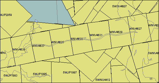
| Image ID | Comments | Year | Scale | Azimuth | Latitude | Longitude |
| 5WJP1993 | Bohemia River - mouth to Rt 213 bridge | 1993 | 40000 | 087.6 | 39.462 | -75.916 |
| 5WJP1995 | Bohemia River, L. Bohemia Cr., Gr. Bohemia Cr. | 1993 | 40000 | 085.6 | 39.465 | -75.833 |
| 5WJP1997 | C&D canal | 1993 | 40000 | 088.6 | 39.469 | -75.747 |
| 5WJP1999 | C&D canal | 1993 | 40000 | 275.2 | 39.527 | -75.659 |
| 5WJP2001 | C&D canal | 1993 | 40000 | 275.8 | 39.533 | -75.744 |
| 5WJP2003 | C&D canal, Chesapeake end | 1993 | 40000 | 275.2 | 39.538 | -75.828 |
| 5WJP2005 | Elk R. , C&D canal | 1993 | 40000 | 275.7 | 39.543 | -75.910 |
| 5WJP2059 | North East River, North East, MD | 1993 | 40000 | 224.5 | 39.594 | -75.931 |
| 5WNU4392 | | 1998 | 48000 | 334.7 | 39.419 | -75.562 |
| 5WNU4394 | | 1998 | 48000 | 332.8 | 39.483 | -75.603 |
| 5WNU4396 | C&D Canal, DE end, Rt 1 bridge | 1998 | 48000 | 332.5 | 39.547 | -75.645 |
| 5WNU4398 | | 1998 | 48000 | 333.3 | 39.611 | -75.686 |
| 5WNU4400 | | 1998 | 48000 | 333.8 | 39.674 | -75.729 |
| 5WNU4406 | | 1998 | 48000 | 175.0 | 39.646 | -75.676 |
| 5WNU4408 | C&D Canal, Rt 1 bridge (east is up) | 1998 | 48000 | 175.3 | 39.582 | -75.669 |
| 5WNU4410 | C&D Canal, Rt 1 bridge (east is up) | 1998 | 48000 | 175.9 | 39.517 | -75.662 |
| 5WNU4412 | | 1998 | 48000 | 175.7 | 39.453 | -75.655 |
| 5WNU4460 | | 1998 | 48000 | 174.6 | 39.667 | -75.587 |
| 5WNU4462 | DE Bay at east end of C&D canal | 1998 | 48000 | 175.7 | 39.590 | -75.578 |
| 5WNU4464 | DE Bay S of east end of C&D canal | 1998 | 48000 | 176.3 | 39.515 | -75.571 |
| 5WNU4466 | DE Bay | 1998 | 48000 | 176.2 | 39.439 | -75.564 |
| 5WNV4531 | DE Bay | 1998 | 48000 | 309.8 | 39.483 | -75.495 |
| 5WNV4533 | DE Bay at east end of C&D canal | 1998 | 48000 | 311.0 | 39.537 | -75.573 |
| 5WNV4535 | | 1998 | 48000 | 313.6 | 39.590 | -75.654 |
| 5WNV4539 | | 1998 | 48000 | 161.6 | 39.643 | -75.564 |
| 5WNV4541 | | 1998 | 48000 | 161.2 | 39.577 | -75.536 |
| 5WNV4543 | | 1998 | 48000 | 163.2 | 39.511 | -75.507 |
| 5WNV4545 | | 1998 | 48000 | 162.7 | 39.445 | -75.481 |
| 5WNV4547 | | 1998 | 48000 | 041.6 | 39.521 | -75.690 |
| 5WNV4549 | C&D Canal, Rt 1 bridge (SE is up) | 1998 | 48000 | 033.8 | 39.569 | -75.641 |
| 5WNV4551 | DE Bay N of E end of C&D canal | 1998 | 48000 | 040.9 | 39.617 | -75.593 |
| 5WNV4553 | DE Bay, DE Mem Bridge | 1998 | 48000 | 037.4 | 39.664 | -75.545 |
| 5WNV4603 | C&D Canal, DE end, Rt 1 bridge (NW is up) | 1998 | 30000 | 037.3 | 39.537 | -75.683 |
| 5WNV4605 | C&D Canal, DE end, Rt 1 bridge (NW is up) | 1998 | 30000 | 036.2 | 39.574 | -75.645 |
| 5WNV4607 | | 1998 | 30000 | 037.6 | 39.613 | -75.608 |
| 5WNV4609 | | 1998 | 30000 | 036.6 | 39.652 | -75.571 |
| 5WNV4627 | C&D canal, DE Bay end | 1998 | 30000 | 258.9 | 39.564 | -75.565 |
| 5WNV4629 | C&D Canal, Rt 1 bridge (east is up) | 1998 | 30000 | 260.5 | 39.557 | -75.619 |
| 5WNV4631 | C&D Canal, Rt 1 bridge (east is up) | 1998 | 30000 | 262.7 | 39.550 | -75.675 |
| 5WNV4633 | C&D Canal | 1998 | 30000 | 258.2 | 39.543 | -75.731 |
| 5WNV4635 | C&D Canal | 1998 | 30000 | 260.8 | 39.535 | -75.785 |
| 5WNV4637 | C&D canal, Chesapeake end | 1998 | 30000 | 259.5 | 39.527 | -75.839 |
| 5WNV4639 | Elk River | 1998 | 30000 | 258.3 | 39.519 | -75.894 |
Top of the Bay
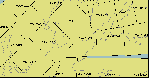
| Image ID | Comments | Year | Scale | Azimuth | Latitude | Longitude |
| 5WJP1987 | | 1993 | 40000 | 088.1 | 39.454 | -76.176 |
| 5WJP1989 | Sandy Pt. | 1993 | 40000 | 088.7 | 39.457 | -76.088 |
| 5WJP1991 | Turkey Pt | 1993 | 40000 | 086.8 | 39.460 | -76.001 |
| 5WJP1993 | Bohemia River - mouth to Rt 213 bridge | 1993 | 40000 | 087.6 | 39.462 | -75.916 |
| 5WJP1995 | Bohemia River, L. Bohemia Cr., Gr. Bohemia Cr. | 1993 | 40000 | 085.6 | 39.465 | -75.833 |
| 5WJP2003 | C&D canal, Chesapeake end | 1993 | 40000 | 275.2 | 39.538 | -75.828 |
| 5WJP2005 | Elk R. , C&D canal | 1993 | 40000 | 275.7 | 39.543 | -75.910 |
| 5WJP2007 | Mouth of NE River, Carpener Pt., Red Pt., Hance Pt. | 1993 | 40000 | 274.7 | 39.549 | -75.997 |
| 5WJP2009 | Susquehanna R. mouth, I 95 bridge, Garrett I., Harve De Grace, MD | 1993 | 40000 | 274.1 | 39.556 | -76.082 |
| 5WJP2011 | | 1993 | 40000 | 274.7 | 39.562 | -76.169 |
| 5WJP2019 | Susquehanna R. mouth, I 95 bridge, Garrett I., Harve De Grace, MD | 1993 | 40000 | 146.3 | 39.572 | -76.111 |
| 5WJP2021 | C Bay S. of Harve De Grace | 1993 | 40000 | 146.6 | 39.514 | -76.062 |
| 5WJP2023 | Susquehanna R., I 95 bridge, Garrett I. (NE is up) | 1993 | 40000 | 225.3 | 39.582 | -76.129 |
| 5WJP2025 | | 1993 | 40000 | 224.3 | 39.534 | -76.191 |
| 5WJP2027 | Upper reaches of Bush R. | 1993 | 40000 | 223.2 | 39.485 | -76.253 |
| 5WJP2049 | Upper reaches of Bush R. | 1993 | 40000 | 044.5 | 39.442 | -76.210 |
| 5WJP2051 | Aberdeen, MD | 1993 | 40000 | 042.4 | 39.491 | -76.150 |
| 5WJP2053 | Susquehanna R. mouth, I 95 bridge, Garrett I., Harve De Grace, MD | 1993 | 40000 | 044.3 | 39.539 | -76.091 |
| 5WJP2055 | | 1993 | 40000 | 045.2 | 39.589 | -76.030 |
| 5WJP2059 | North East River, North East, MD | 1993 | 40000 | 224.5 | 39.594 | -75.931 |
| 5WJP2061 | Mouth of NE River, Carpener Pt., Red Pt., Hance Pt. | 1993 | 40000 | 223.9 | 39.548 | -75.990 |
| 5WJP2063 | | 1993 | 40000 | 223.8 | 39.498 | -76.052 |
| 5WJP2065 | Sandy Pt., Pesutie I., Aberdeen Prooving Grounds | 1993 | 40000 | 224.1 | 39.449 | -76.113 |
| 5WJP2067 | Aberdeen Prooving Grounds, Romney Cr. | 1993 | 40000 | 223.9 | 39.403 | -76.171 |
| 5WJP2069 | Mouth of Bush R. | 1993 | 40000 | 223.6 | 39.355 | -76.231 |
| 5WK26183 | Still Pond, Worton Cr | 1993 | 40000 | 022.1 | 39.339 | -76.160 |
| 5WK26185 | Still Pond, Howell Pt., Romney Cr. | 1993 | 40000 | 021.5 | 39.402 | -76.136 |
| 5WK26187 | Aberdeen Prooving Grounds, Sandy Pt. | 1993 | 40000 | 024.8 | 39.464 | -76.115 |
| 5WK26189 | Sandy Pt., Pesutie I., Aberdeen Prooving Grounds | 1993 | 40000 | 021.4 | 39.524 | -76.086 |
| 5WK26193 | Sandy Pt., Turkey Pt., Pond Cr. | 1993 | 40000 | 205.9 | 39.450 | -76.037 |
| 5WK26195 | Mounth of Sassafras R. | 1993 | 40000 | 199.6 | 39.380 | -76.078 |
| 5WK26223 | | 1993 | 40000 | 180.4 | 39.363 | -76.009 |
| 5WK26247 | | 1993 | 40000 | 270.6 | 39.372 | -75.836 |
| 5WK26249 | Sassafras R. Back Cr. to Georgetown, MD | 1993 | 40000 | 269.3 | 39.373 | -75.927 |
| 5WK26251 | Sassafras R. Howell Pt. to Back Cr. | 1993 | 40000 | 270.1 | 39.374 | -76.004 |
| 5WK26253 | Howell Pt. | 1993 | 40000 | 272.6 | 39.374 | -76.084 |
| 5WK26255 | | 1993 | 40000 | 298.3 | 39.388 | -76.148 |
| 5WK26285 | | 1993 | 40000 | 005.5 | 39.332 | -76.010 |
| 5WNV4637 | C&D Canal, Cheasapeake end | 1998 | 30000 | 259.5 | 39.527 | -75.839 |
| 5WNV4639 | | 1998 | 30000 | 258.3 | 39.519 | -75.894 |
| 5WNV4641 | | 1998 | 30000 | 259.4 | 39.511 | -75.950 |
Back River, Middle River, Hawk Cove
| Image ID | Comments | Year | Scale | Azimuth | Latitude | Longitude |
| 5WJP1955 | | 1993 | 40000 | 169.7 | 39.214 | -76.590 |
| 5WJP1979 | | 1993 | 40000 | 348.3 | 39.171 | -76.512 |
| 5WJP1981 | | 1993 | 40000 | 352.2 | 39.237 | -76.531 |
| 5WJP1983 | | 1993 | 40000 | 350.2 | 39.302 | -76.544 |
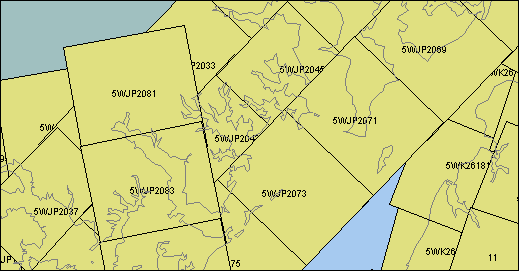
| 5WJP2029 | | 1993 | 40000 | 223.3 | 39.437 | -76.311 |
| 5WJP2031 | | 1993 | 40000 | 225.6 | 39.390 | -76.369 |
| 5WJP2033 | | 1993 | 40000 | 224.1 | 39.344 | -76.431 |
| 5WJP2035 | | 1993 | 40000 | 222.8 | 39.296 | -76.490 |
| 5WJP2037 | | 1993 | 40000 | 224.7 | 39.246 | -76.549 |
| 5WJP2039 | | 1993 | 40000 | 042.1 | 39.199 | -76.511 |
| 5WJP2041 | | 1993 | 40000 | 043.8 | 39.246 | -76.454 |
| 5WJP2043 | | 1993 | 40000 | 042.6 | 39.295 | -76.393 |
| 5WJP2045 | | 1993 | 40000 | 043.2 | 39.341 | -76.336 |
| 5WJP2047 | | 1993 | 40000 | 044.7 | 39.390 | -76.275 |
| 5WJP2049 | | 1993 | 40000 | 044.5 | 39.442 | -76.210 |
| 5WJP2067 | | 1993 | 40000 | 223.9 | 39.403 | -76.171 |
| 5WJP2069 | | 1993 | 40000 | 223.6 | 39.355 | -76.231 |
| 5WJP2071 | | 1993 | 40000 | 224.0 | 39.307 | -76.291 |
| 5WJP2073 | | 1993 | 40000 | 223.9 | 39.258 | -76.352 |
| 5WJP2075 | | 1993 | 40000 | 223.9 | 39.211 | -76.409 |
| 5WJP2077 | | 1993 | 40000 | 223.3 | 39.162 | -76.471 |
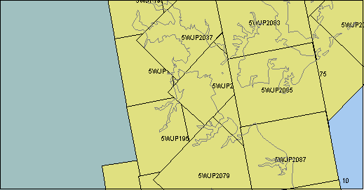
| 5WJP2081 | | 1993 | 40000 | 169.6 | 39.325 | -76.482 |
| 5WJP2083 | | 1993 | 40000 | 168.5 | 39.260 | -76.466 |
| 5WJP2085 | | 1993 | 40000 | 168.9 | 39.195 | -76.450 |
| 5WK26177 | | 1993 | 40000 | 015.2 | 39.159 | -76.240 |
| 5WK26179 | | 1993 | 40000 | 015.8 | 39.219 | -76.210 |
| 5WK26181 | | 1993 | 40000 | 021.1 | 39.277 | -76.192 |
| 5WK26183 | | 1993 | 40000 | 022.1 | 39.339 | -76.160 |
| 5WK26255 | | 1993 | 40000 | 298.3 | 39.388 | -76.148 |
Bodkin Cr., Potapsco River
| Image ID | Comments | Year | Scale | Azimuth | Latitude | Longitude |
| 5WJN1891 | | 1993 | 40800 | 171.0 | 39.090 | -76.606 |
| 5WJP1953 | Baltimore, Inner Harbor | 1993 | 40000 | 170.0 | 39.282 | -76.606 |
| 5WJP1955 | | 1993 | 40000 | 169.7 | 39.214 | -76.590 |
| 5WJP1957 | | 1993 | 40000 | 168.9 | 39.149 | -76.575 |
| 5WJP1959 | | 1993 | 40000 | 168.9 | 39.083 | -76.560 |
| 5WJP1977 | | 1993 | 40000 | 348.5 | 39.105 | -76.497 |
| 5WJP1979 | | 1993 | 40000 | 348.3 | 39.171 | -76.512 |
| 5WJP1981 | | 1993 | 40000 | 352.2 | 39.237 | -76.531 |
| 5WJP1983 | | 1993 | 40000 | 350.2 | 39.302 | -76.544 |
| 5WJP2035 | | 1993 | 40000 | 222.8 | 39.296 | -76.490 |
| 5WJP2037 | | 1993 | 40000 | 224.7 | 39.246 | -76.549 |
| 5WJP2039 | | 1993 | 40000 | 042.1 | 39.199 | -76.511 |
| 5WJP2041 | | 1993 | 40000 | 043.8 | 39.246 | -76.454 |
| 5WJP2043 | | 1993 | 40000 | 042.6 | 39.295 | -76.393 |
| 5WJP2073 | | 1993 | 40000 | 223.9 | 39.258 | -76.352 |
| 5WJP2075 | | 1993 | 40000 | 223.9 | 39.211 | -76.409 |
| 5WJP2077 | | 1993 | 40000 | 223.3 | 39.162 | -76.471 |
| 5WJP2079 | | 1993 | 40000 | 223.2 | 39.114 | -76.529 |
| 5WJP2081 | | 1993 | 40000 | 169.6 | 39.325 | -76.482 |
| 5WJP2083 | | 1993 | 40000 | 168.5 | 39.260 | -76.466 |
| 5WJP2085 | | 1993 | 40000 | 168.9 | 39.195 | -76.450 |
| 5WJP2087 | | 1993 | 40000 | 169.3 | 39.129 | -76.434 |
| 5WJP2089 | | 1993 | 40000 | 169.8 | 39.064 | -76.419 |
Severn River, Magothy River
| Image ID | Comments | Year | Scale | Azimuth | Latitude | Longitude |
| 5WJN1891 | | 1993 | 40800 | 171.0 | 39.090 | -76.606 |
| 5WJN1893 | Round Bay on Severn R. | 1993 | 40700 | 173.1 | 39.023 | -76.594 |
| 5WJN1895 | Upper South R., Rt 2 bridge | 1993 | 40800 | 172.5 | 38.960 | -76.584 |
| 5WJP1957 | | 1993 | 40000 | 168.9 | 39.149 | -76.575 |
| 5WJP1959 | Severn R. above Round Bay, Upper Magothy R. | 1993 | 40000 | 168.9 | 39.083 | -76.560 |
| 5WJP1961 | Severn R., Round Bay to Naval Academy | 1993 | 40000 | 168.6 | 39.017 | -76.543 |
| 5WJP1963 | South River | 1993 | 40000 | 170.3 | 38.950 | -76.526 |
| 5WJP1971 | Thomas Pt. | 1993 | 40000 | 347.8 | 38.908 | -76.449 |
| 5WJP1973 | Annapolis, Tolly Pt, Whitehall Cr, Severn R. to Rt 50 bridge | 1993 | 40000 | 351.9 | 38.973 | -76.465 |
| 5WJP1975 | | 1993 | 40000 | 350.0 | 39.039 | -76.481 |
| 5WJP1977 | Magothy R., Bodkin Cr. | 1993 | 40000 | 348.5 | 39.105 | -76.497 |
| 5WJP1979 | | 1993 | 40000 | 348.3 | 39.171 | -76.512 |
| 5WJP2077 | Potapsco R., | 1993 | 40000 | 223.3 | 39.162 | -76.471 |
| 5WJP2079 | | 1993 | 40000 | 223.2 | 39.114 | -76.529 |
| 5WJP2087 | | 1993 | 40000 | 169.3 | 39.129 | -76.434 |
| 5WJP2089 | | 1993 | 40000 | 169.8 | 39.064 | -76.419 |
| 5WJP2091 | Whitehall Cr., west end of bay bridge | 1993 | 40000 | 168.6 | 38.998 | -76.404 |
| 5WJP2093 | West shore of Kent I. North of Bloddy Pt. | 1993 | 40000 | 169.0 | 38.934 | -76.387 |
Chester River
| Image ID | Comments | Year | Scale | Azimuth | Latitude | Longitude |
| 5WHE9637 | | 1992 | 20000 | 334.1 | 39.094 | -76.221 |
| 5WHE9639 | | 1992 | 20000 | 334.4 | 39.125 | -76.241 |
| 5WHE9641 | | 1992 | 20000 | 334.1 | 39.156 | -76.260 |
| 5WHE9647 | | 1992 | 20000 | 288.1 | 38.977 | -76.278 |
| 5WK26171 | | 1993 | 40000 | 017.6 | 38.976 | -76.318 |
| 5WK26173 | | 1993 | 40000 | 023.9 | 39.042 | -76.296 |
| 5WK26175 | | 1993 | 40000 | 018.1 | 39.102 | -76.264 |
| 5WK26177 | Rock Hall, Swan Cr. | 1993 | 40000 | 015.2 | 39.159 | -76.240 |
| 5WK26179 | | 1993 | 40000 | 015.8 | 39.219 | -76.210 |
| 5WK26201 | | 1993 | 40000 | 198.5 | 39.199 | -76.158 |
| 5WK26203 | | 1993 | 40000 | 197.5 | 39.143 | -76.182 |
| 5WK26205 | | 1993 | 40000 | 196.8 | 39.087 | -76.207 |
| 5WK26207 | | 1993 | 40000 | 204.9 | 39.027 | -76.233 |
| 5WK26209 | | 1993 | 40000 | 196.9 | 38.972 | -76.261 |
| 5WK26229 | | 1993 | 40000 | 192.5 | 39.198 | -76.086 |
| 5WK26231 | | 1993 | 40000 | 201.7 | 39.143 | -76.111 |
| 5WK26233 | | 1993 | 40000 | 198.2 | 39.092 | -76.140 |
| 5WK26235 | | 1993 | 40000 | 192.0 | 39.038 | -76.157 |
| 5WK26237 | | 1993 | 40000 | 195.4 | 38.985 | -76.182 |
| 5WK26271 | | 1993 | 40000 | 017.7 | 38.952 | -76.194 |
| 5WK26273 | | 1993 | 40000 | 014.0 | 39.010 | -76.167 |
| 5WK26275 | | 1993 | 40000 | 020.5 | 39.065 | -76.151 |
| 5WK26277 | | 1993 | 40000 | 016.7 | 39.117 | -76.122 |
| 5WK26279 | | 1993 | 40000 | 010.1 | 39.170 | -76.094 |
| 5WK26281 | | 1993 | 40000 | 030.2 | 39.226 | -76.075 |
| 5WK36311 | | 1993 | 40000 | 210.4 | 39.179 | -76.012 |
| 5WK36312 | | 1993 | 40000 | 210.5 | 39.150 | -76.034 |
| 5WK36313 | | 1993 | 40000 | 193.7 | 39.118 | -76.058 |
| 5WK36315 | | 1993 | 40000 | 197.2 | 39.047 | -76.083 |
| 5WK36317 | | 1993 | 40000 | 202.4 | 38.977 | -76.114 |
| 5WK36361 | | 1993 | 40000 | 026.4 | 39.004 | -76.026 |
Bridge Area
| Image ID | Comments | Year | Scale | Azimuth | Latitude | Longitude |
| 5WHE9637 | | 1992 | 20000 | 334.1 | 39.094 | -76.221 |
| 5WHE9643 | | 1992 | 20000 | 288.1 | 38.956 | -76.199 |
| 5WHE9645 | | 1992 | 20000 | 289.0 | 38.966 | -76.238 |
| 5WHE9647 | West of Kent Narrows | 1992 | 20000 | 288.1 | 38.977 | -76.278 |
| 5WJP1961 | | 1993 | 40000 | 168.6 | 39.017 | -76.543 |
| 5WJP1963 | South River | 1993 | 40000 | 170.3 | 38.950 | -76.526 |
| 5WJP1965 | Rhode River, South R. - Selby Bay | 1993 | 40000 | 169.8 | 38.883 | -76.511 |
| 5WJP1971 | Thomas Pt. | 1993 | 40000 | 347.8 | 38.908 | -76.449 |
| 5WJP1973 | Annapolis, Tolly Pt, Whitehall Cr, Severn R. to Rt 50 bridge | 1993 | 40000 | 351.9 | 38.973 | -76.465 |
| 5WJP1975 | | 1993 | 40000 | 350.0 | 39.039 | -76.481 |
| 5WJP1977 | | 1993 | 40000 | 348.5 | 39.105 | -76.497 |
| 5WJP2089 | | 1993 | 40000 | 169.8 | 39.064 | -76.419 |
| 5WJP2091 | Whitehall Cr., west end of bay bridge | 1993 | 40000 | 168.6 | 38.998 | -76.404 |
| 5WJP2093 | West shore of Kent I. North of Bloddy Pt. | 1993 | 40000 | 169.0 | 38.934 | -76.387 |
| 5WJP2095 | Bloddy Pt, Kent Pt | 1993 | 40000 | 170.4 | 38.867 | -76.371 |
| 5WK26167 | Bloddy Pt, Kent Pt | 1993 | 40000 | 017.3 | 38.849 | -76.380 |
| 5WK26169 | Kent I. North of Bloddy Pt. | 1993 | 40000 | 017.8 | 38.919 | -76.349 |
| 5WK26171 | Kent I., east end of bay bridge | 1993 | 40000 | 017.6 | 38.976 | -76.318 |
| 5WK26173 | | 1993 | 40000 | 023.9 | 39.042 | -76.296 |
| 5WK26175 | | 1993 | 40000 | 018.1 | 39.102 | -76.264 |
| 5WK26205 | | 1993 | 40000 | 196.8 | 39.087 | -76.207 |
| 5WK26207 | | 1993 | 40000 | 204.9 | 39.027 | -76.233 |
| 5WK26209 | Kent Narrows | 1993 | 40000 | 196.9 | 38.972 | -76.261 |
| 5WK26211 | Crab Alley Bay | 1993 | 40000 | 194.7 | 38.917 | -76.282 |
| 5WK26213 | Eastern Bay between Kent Pt. And Rich Neck | 1993 | 40000 | 195.9 | 38.860 | -76.301 |
| 5WK26233 | | 1993 | 40000 | 198.2 | 39.092 | -76.140 |
| 5WK26235 | | 1993 | 40000 | 192.0 | 39.038 | -76.157 |
| 5WK26237 | | 1993 | 40000 | 195.4 | 38.985 | -76.182 |
| 5WK26239 | | 1993 | 40000 | 204.4 | 38.924 | -76.202 |
| 5WK26241 | Chestertown (north is at bottom) | 1993 | 40000 | 207.1 | 38.874 | -76.227 |
| 5WK26267 | Miles River, Tilghman Pt., Bennett Pt. | 1993 | 40000 | 027.4 | 38.850 | -76.243 |
| 5WK26269 | Eastern Bay, Prospect Bay | 1993 | 40000 | 021.8 | 38.901 | -76.214 |
| 5WK26271 | | 1993 | 40000 | 017.7 | 38.952 | -76.194 |
| 5WK26273 | | 1993 | 40000 | 014.0 | 39.010 | -76.167 |
| 5WK26275 | | 1993 | 40000 | 020.5 | 39.065 | -76.151 |
| 5WK36317 | | 1993 | 40000 | 202.4 | 38.977 | -76.114 |
| 5WK36319 | | 1993 | 40000 | 199.9 | 38.918 | -76.141 |
| 5WK36321 | | 1993 | 40000 | 201.8 | 38.854 | -76.170 |
West River, South River across to Eastern Bay
| Image ID | Comment | Year | Scale | Azimuth | Latitude | Longitude |
| 5whe9647 | West of Kent Narrows | 1992 | 20000 | 288.1 | 38.977 | -76.278 |
| 5wjn1895 | Upper reaches of South R. | 1993 | 40800 | 172.5 | 38.960 | -76.584 |
| 5wjn1897 | Rhode R. - western part, camp Letts | 1993 | 40900 | 173.6 | 38.895 | -76.573 |
| 5wjn1899 | West River, Shady Side | 1993 | 41000 | 173.5 | 38.829 | -76.563 |
| 5wjn1901 | Herring Bay | 1993 | 41000 | 172.5 | 38.760 | -76.552 |
| 5wjp1963 | South River | 1993 | 40000 | 170.3 | 38.950 | -76.526 |
| 5wjp1965 | Rhode River, South R. - Selby Bay | 1993 | 40000 | 169.8 | 38.883 | -76.511 |
| 5wjp1967 | Shady Side | 1993 | 40000 | 167.9 | 38.816 | -76.495 |
| 5wjp1969 | East of Herring Bay | 1993 | 40000 | 169.4 | 38.749 | -76.478 |
| 5wjp1971 | Thomas Pt. | 1993 | 40000 | 347.8 | 38.908 | -76.449 |
| 5wjp1973 | Annapolis, Tolly Pt, Whitehall Cr, Severn R. to Rt 50 bridge | 1993 | 40000 | 351.9 | 38.973 | -76.465 |
| 5wjp2091 | Whitehall Cr., west end of bay bridge | 1993 | 40000 | 168.6 | 38.998 | -76.404 |
| 5wjp2093 | West shore of Kent I. North of Bloddy Pt. | 1993 | 40000 | 169.0 | 38.934 | -76.387 |
| 5wjp2095 | Bloddy Pt, Kent Pt | 1993 | 40000 | 170.4 | 38.867 | -76.371 |
| 5wjp2097 | Poplar I. to Kent Pt. | 1993 | 40000 | 169.7 | 38.801 | -76.357 |
| 5wk26165 | NW of Poplar Is. | 1993 | 40000 | 025.8 | 38.793 | -76.419 |
| 5wk26167 | Bloddy Pt, Kent Pt | 1993 | 40000 | 017.3 | 38.849 | -76.380 |
| 5wk26169 | Kent I. North of Bloddy Pt. | 1993 | 40000 | 017.8 | 38.919 | -76.349 |
| 5wk26171 | Kent I., east end of bay bridge | 1993 | 40000 | 017.6 | 38.976 | -76.318 |
| 5wk26209 | Kent Narrows | 1993 | 40000 | 196.9 | 38.972 | -76.261 |
| 5wk26211 | Crab Alley Bay | 1993 | 40000 | 194.7 | 38.917 | -76.282 |
| 5wk26213 | Eastern Bay between Kent Pt. And Rich Neck | 1993 | 40000 | 195.9 | 38.860 | -76.301 |
| 5wk26215 | Eastern Bay, Poplar I. to Wades Pt. | 1993 | 40000 | 202.2 | 38.794 | -76.331 |
| 5wk26217 | Poplar I., Tilghman I. | 1993 | 40000 | 197.5 | 38.747 | -76.358 |
| 5wk26241 | Chestertown (north is at bottom) | 1993 | 40000 | 207.1 | 38.874 | -76.227 |
| 5wk26243 | Chester R. above Chestertown (north at bottom) | 1993 | 40000 | 194.8 | 38.820 | -76.251 |
| 5wk26263 | Harris Creek, Broad Creek | 1993 | 40000 | 010.6 | 38.745 | -76.287 |
| 5wk26265 | Broad Creek, St Michaels | 1993 | 40000 | 012.2 | 38.794 | -76.259 |
| 5wk26267 | Miles River, Tilghman Pt., Bennett Pt. | 1993 | 40000 | 027.4 | 38.850 | -76.243 |
| 5wk26269 | Eastern Bay, Prospect Bay | 1993 | 40000 | 021.8 | 38.901 | -76.214 |
| 5wk36407 | Tilghman I., Harris Cr. | 1993 | 40000 | 307.7 | 38.729 | -76.292 |
| 5wk36409 | Poplar I. | 1993 | 40000 | 286.9 | 38.763 | -76.360 |
| 5wk36411 | W. of Poplar I. | 1993 | 40000 | 289.3 | 38.778 | -76.421 |
West Rver south to Herring Bay, across to St. Michaels
| Image ID | Comment | Year | Scale | Azimuth | Latitude | Longitude |
| 5wjn1897 | Rhode R. - western part, camp Letts | 1993 | 40900 | 173.6 | 38.895 | -76.573 |
| 5wjn1899 | West River, Shady Side | 1993 | 41000 | 173.5 | 38.829 | -76.563 |
| 5wjn1901 | Herring Bay | 1993 | 41000 | 172.5 | 38.760 | -76.552 |
| 5wjn1903 | S. of Herring Bay | 1993 | 41000 | 172.2 | 38.692 | -76.541 |
| 5wjp1965 | Rhode River, South R. - Selby Bay | 1993 | 40000 | 169.8 | 38.883 | -76.511 |
| 5wjp1967 | Bloddy Pt, Kent Pt | 1993 | 40000 | 167.9 | 38.816 | -76.495 |
| 5wjp1969 | Kent I. North of Bloddy Pt. | 1993 | 40000 | 169.4 | 38.749 | -76.478 |
| 5wjp1971 | Thomas Pt. | 1993 | 40000 | 347.8 | 38.908 | -76.449 |
| 5wjp2095 | Bloddy Pt, Kent Pt | 1993 | 40000 | 170.4 | 38.867 | -76.371 |
| 5wjp2097 | Poplar I. to Kent Pt. | 1993 | 40000 | 169.7 | 38.801 | -76.357 |
| 5wk26165 | NW of Poplar Is. | 1993 | 40000 | 025.8 | 38.793 | -76.419 |
| 5wk26167 | Bloddy Pt, Kent Pt | 1993 | 40000 | 017.3 | 38.849 | -76.380 |
| 5wk26169 | Kent I. North of Bloddy Pt. | 1993 | 40000 | 017.8 | 38.919 | -76.349 |
| 5wk26211 | Crab Alley Bay | 1993 | 40000 | 194.7 | 38.918 | -76.283 |
| 5wk26213 | Eastern Bay between Kent Pt. And Rich Neck | 1993 | 40000 | 195.9 | 38.860 | -76.301 |
| 5wk26215 | Eastern Bay, Poplar I. to Wades Pt. | 1993 | 40000 | 202.2 | 38.794 | -76.331 |
| 5wk26217 | Poplar I., Tilghman I. | 1993 | 40000 | 197.5 | 38.747 | -76.358 |
| 5wk26219 | SW of Tilghman I. | 1993 | 40000 | 186.0 | 38.688 | -76.370 |
| 5wk26241 | Chestertown (north is at bottom) | 1993 | 40000 | 207.1 | 38.874 | -76.227 |
| 5wk26243 | Chester R. above Chestertown (north at bottom) | 1993 | 40000 | 194.8 | 38.820 | -76.252 |
| 5wk26261 | Tilghman I., Choptank R. | 1993 | 40000 | 018.5 | 38.689 | -76.316 |
| 5wk26263 | Harris Cr, Broad Cr | 1993 | 40000 | 010.6 | 38.745 | -76.287 |
| 5wk26265 | Broad Creek, St Michaels | 1993 | 40000 | 012.2 | 38.794 | -76.259 |
| 5wk26267 | Miles River, Tilghman Pt., Bennett Pt. | 1993 | 40000 | 027.4 | 38.850 | -76.243 |
| 5wk26269 | Eastern Bay, Prospect Bay | 1993 | 40000 | 021.8 | 38.902 | -76.214 |
| 5wk36321 | Miles River, Wye River | 1993 | 40000 | 201.8 | 38.854 | -76.170 |
| 5wk36323 | St. Michaels, Miles River | 1993 | 40000 | 193.9 | 38.794 | -76.198 |
| 5wk36325 | Broad Cr., Edge Cr. | 1993 | 40000 | 193.6 | 38.734 | -76.225 |
| 5wk36327 | Choptank R., Benoni Pt. | 1993 | 40000 | 203.0 | 38.661 | -76.257 |
| 5wk36405 | Choptank R., Broad Cr. to Tred Avon R. | 1993 | 40000 | 307.2 | 38.694 | -76.229 |
| 5wk36407 | Tilghman I., Harris Cr. | 1993 | 40000 | 307.7 | 38.729 | -76.292 |
| 5wk36409 | Poplar I. | 1993 | 40000 | 286.9 | 38.763 | -76.360 |
| 5wk36411 | W. of Poplar I. | 1993 | 40000 | 289.3 | 38.778 | -76.421 |
Eastern Bay, Kent Is.
| Image ID | Comment | Year | Scale | Azimuth | Latitude | Longitude |
| 5WHE9643 | East of Kent Narrows | 1992 | 20000 | 288.1 | 38.956 | -76.199 |
| 5WHE9645 | Kent Narrows | 1992 | 20000 | 289.0 | 38.966 | -76.238 |
| 5WHE9647 | West of Kent Narrows | 1992 | 20000 | 288.1 | 38.977 | -76.278 |
| 5WJP1971 | Thomas Pt. | 1993 | 40000 | 347.8 | 38.908 | -76.449 |
| 5WJP2089 | Magothy R. mouth, Gibson I. | 1993 | 40000 | 169.8 | 39.064 | -76.419 |
| 5WJP2091 | Whitehall Cr., west end of bay bridge | 1993 | 40000 | 168.6 | 38.998 | -76.404 |
| 5WJP2093 | West shore of Kent I. North of Bloddy Pt. | 1993 | 40000 | 169.0 | 38.934 | -76.387 |
| 5WJP2095 | Bloddy Pt, Kent Pt | 1993 | 40000 | 170.4 | 38.867 | -76.371 |
| 5WJP2097 | Poplar I. to Kent Pt. | 1993 | 40000 | 169.7 | 38.801 | -76.357 |
| 5WK26167 | Bloddy Pt, Kent Pt | 1993 | 40000 | 017.3 | 38.849 | -76.380 |
| 5WK26169 | Kent I. North of Bloddy Pt. | 1993 | 40000 | 017.8 | 38.919 | -76.349 |
| 5WK26171 | Kent I., east end of bay bridge | 1993 | 40000 | 017.6 | 38.976 | -76.318 |
| 5WK26173 | Kent I., Love Pt. | 1993 | 40000 | 023.9 | 39.042 | -76.296 |
| 5WK26207 | Chester river, Eastern Neck I. | 1993 | 40000 | 204.9 | 39.027 | -76.233 |
| 5WK26209 | Kent Narrows | 1993 | 40000 | 196.9 | 38.972 | -76.261 |
| 5WK26211 | Crab Alley Bay | 1993 | 40000 | 194.7 | 38.917 | -76.282 |
| 5WK26213 | Eastern Bay between Kent Pt. And Rich Neck | 1993 | 40000 | 195.9 | 38.860 | -76.301 |
| 5WK26215 | Eastern Bay, Poplar I. to Wades Pt. | 1993 | 40000 | 202.2 | 38.794 | -76.331 |
| 5WK26235 | Chester R., Reed Cr. to Queenstown (N at bottom) | 1993 | 40000 | 192.0 | 39.038 | -76.157 |
| 5WK26237 | Chester R., Corsica R., Comegys Bight, Nichols Pt.(N at bottom) | 1993 | 40000 | 195.4 | 38.985 | -76.182 |
| 5WK26239 | Chester R. Fryingpan Pt. to Deep Pt. (N at bottom) | 1993 | 40000 | 204.4 | 38.924 | -76.202 |
| 5WK26241 | Chestertown (N at bottom) | 1993 | 40000 | 207.1 | 38.874 | -76.227 |
| 5WK26243 | Chester R. above Chestertown (N at bottom) | 1993 | 40000 | 194.8 | 38.820 | -76.251 |
| 5WK26267 | Miles River, Tilghman Pt., Bennett Pt. | 1993 | 40000 | 027.4 | 38.850 | -76.243 |
| 5WK26269 | Eastern Bay, Prospect Bay | 1993 | 40000 | 021.8 | 38.901 | -76.214 |
| 5WK26271 | East of Kent Narrows | 1993 | 40000 | 017.7 | 38.952 | -76.194 |
| 5WK26273 | Chester R. , Queenstown, Piney Pt., Hall Pt. | 1993 | 40000 | 014.0 | 39.010 | -76.167 |
| 5WK26275 | Chester R., Nichols Pt., Corsica Cr. Reed Cr. | 1993 | 40000 | 020.5 | 39.065 | -76.151 |
| 5WK36315 | Upper Corsica R., Centerville | 1993 | 40000 | 197.2 | 39.047 | -76.083 |
| 5WK36317 | Wye R. - upper reaches | 1993 | 40000 | 202.4 | 38.977 | -76.114 |
| 5WK36319 | Wye R., Wye I. | 1993 | 40000 | 199.9 | 38.918 | -76.141 |
| 5WK36321 | Bennett Pt., Wye R., Wye East R. | 1993 | 40000 | 201.8 | 38.854 | -76.170 |
| 5WK36355 | Upper reaches of Miles R. | 1993 | 40000 | 021.2 | 38.834 | -76.104 |
| 5WK36357 | Upper reaches of Wye East R. | 1993 | 40000 | 018.1 | 38.892 | -76.082 |
| 5WK36359 | | 1993 | 40000 | 015.1 | 38.950 | -76.052 |
| 5WK36361 | | 1993 | 40000 | 026.4 | 39.004 | -76.026 |
St. Michaels, Tilghman, Oxford
| Image ID | Comment | Year | Scale | Azimuth | Latitude | Longitude |
| 5WJP1967 | Bloddy Pt, Kent Pt | 1993 | 40000 | 167.9 | 38.816 | -76.495 |
| 5WJP1969 | Kent I. North of Bloddy Pt. | 1993 | 40000 | 169.4 | 38.749 | -76.478 |
| 5WJP2095 | Bloddy Pt, Kent Pt | 1993 | 40000 | 170.4 | 38.867 | -76.371 |
| 5WJP2097 | Poplar I. to Kent Pt. | 1993 | 40000 | 169.7 | 38.801 | -76.357 |
| 5WK26165 | NW of Poplar Is. | 1993 | 40000 | 025.8 | 38.793 | -76.419 |
| 5WK26167 | Bloddy Pt, Kent Pt | 1993 | 40000 | 017.3 | 38.849 | -76.380 |
| 5WK26213 | Eastern Bay between Kent Pt. And Rich Neck | 1993 | 40000 | 195.9 | 38.860 | -76.301 |
| 5WK26215 | Eastern Bay, Poplar I. to Wades Pt. | 1993 | 40000 | 202.2 | 38.794 | -76.331 |
| 5WK26217 | Poplar I., Tilghman I. | 1993 | 40000 | 197.5 | 38.747 | -76.358 |
| 5WK26219 | SW of Tilghman I. | 1993 | 40000 | 186.0 | 38.688 | -76.370 |
| 5WK26241 | Chestertown (north is at bottom) | 1993 | 40000 | 207.1 | 38.874 | -76.227 |
| 5WK26243 | Chester R. above Chestertown (north at bottom) | 1993 | 40000 | 194.8 | 38.820 | -76.251 |
| 5WK26259 | SSW of Tilghman I., W of L. Choptank R. | 1993 | 40000 | 358.7 | 38.636 | -76.322 |
| 5WK26261 | Tilghman I., Choptank R. | 1993 | 40000 | 018.5 | 38.689 | -76.316 |
| 5WK26263 | Harris Cr, Broad Cr | 1993 | 40000 | 010.6 | 38.745 | -76.287 |
| 5WK26265 | Broad Creek, St Michaels | 1993 | 40000 | 012.2 | 38.794 | -76.259 |
| 5WK26267 | Miles River, Tilghman Pt., Bennett Pt. | 1993 | 40000 | 027.4 | 38.850 | -76.243 |
| 5WK26269 | Eastern Bay, Prospect Bay | 1993 | 40000 | 021.8 | 38.901 | -76.214 |
| 5WK36321 | Miles River, Wye River | 1993 | 40000 | 201.8 | 38.854 | -76.170 |
| 5WK36323 | St. Michaels, Miles River | 1993 | 40000 | 193.9 | 38.794 | -76.198 |
| 5WK36325 | Broad Cr., Edge Cr. | 1993 | 40000 | 193.6 | 38.734 | -76.225 |
| 5WK36327 | Choptank R., Benoni Pt. | 1993 | 40000 | 203.0 | 38.661 | -76.257 |
| 5WK36349 | Oxford | 1993 | 40000 | 025.5 | 38.672 | -76.180 |
| 5WK36351 | Oxford to St Michaels, Tred Avon R. | 1993 | 40000 | 019.8 | 38.730 | -76.153 |
| 5WK36353 | Upper Tred Avon R., Lower Miles R. | 1993 | 40000 | 015.1 | 38.780 | -76.128 |
| 5WK36355 | Upper reaches of Miles R. | 1993 | 40000 | 021.2 | 38.834 | -76.104 |
| 5WK36363 | N. side of Easton | 1993 | 40000 | 198.4 | 38.784 | -76.061 |
| 5WK36365 | | 1993 | 40000 | 194.0 | 38.726 | -76.089 |
| 5WK36367 | Trd Avon R. east of Oxford, Trippe Cr. | 1993 | 40000 | 201.6 | 38.660 | -76.114 |
| 5WK36403 | Choptank R., Oxford to Lecompte Bay, Island Cr. | 1993 | 40000 | 303.1 | 38.652 | -76.162 |
| 5WK36405 | Choptank R., Broad Cr. to Tred Avon R. | 1993 | 40000 | 307.2 | 38.694 | -76.229 |
| 5WK36407 | Tilghman I., Harris Cr. | 1993 | 40000 | 307.7 | 38.729 | -76.292 |
| 5WK36409 | Poplar I. | 1993 | 40000 | 286.9 | 38.763 | -76.360 |
| 5WK36411 | W. of Poplar I. | 1993 | 40000 | 289.3 | 38.778 | -76.421 |
Cambridge/Choptank
| Image ID | Comments | Year | Scale | Azimuth | Latitude | Longitude |
| 5WHE9649 | West of Cambridge | 1992 | 20000 | 143.7 | 38.601 | -76.101 |
| 5WHE9651 | Cambridge | 1992 | 20000 | 143.7 | 38.573 | -76.075 |
| 5WHE9653 | East of Cambridge | 1992 | 20000 | 143.6 | 38.544 | -76.048 |
| 5WK26219 | SW of Tilghman I. | 1993 | 40000 | 186.0 | 38.688 | -76.370 |
| 5WK26221 | SW of Tilghman I. | 1993 | 40000 | 178.0 | 38.626 | -76.373 |
| 5WK26259 | SSW of Tilghman I., W of L. Choptank R. | 1993 | 40000 | 358.7 | 38.636 | -76.322 |
| 5WK26261 | Tilghman I., Choptank R. | 1993 | 40000 | 018.5 | 38.689 | -76.316 |
| 5WK36325 | Broad Cr., Edge Cr. | 1993 | 40000 | 193.6 | 38.734 | -76.225 |
| 5WK36327 | Choptank R. - Tilghman to Benoni Pt. | 1993 | 40000 | 203.0 | 38.661 | -76.257 |
| 5WK36329 | Trippe Bay, Cook Pt., Todds Pt. | 1993 | 40000 | 194.8 | 38.612 | -76.282 |
| 5WK36333 | Slaughter Cr., N. end of Taylors I. | 1993 | 40000 | 187.5 | 38.485 | -76.335 |
| 5WK36341 | Slaughter Cr., Taylors I. | 1993 | 40000 | 036.4 | 38.450 | -76.277 |
| 5WK36343 | Little Choptank R., Slaughter Cr. | 1993 | 40000 | 021.8 | 38.505 | -76.255 |
| 5WK36345 | Little Choptank R. | 1993 | 40000 | 013.4 | 38.560 | -76.228 |
| 5WK36349 | Oxford | 1993 | 40000 | 025.5 | 38.672 | -76.180 |
| 5WK36351 | Oxford to St Michaels, Tred Avon R. | 1993 | 40000 | 019.8 | 38.730 | -76.153 |
| 5WK36365 | | 1993 | 40000 | 194.0 | 38.726 | -76.089 |
| 5WK36367 | Tred Avon R. east of Oxford, Trippe Cr. | 1993 | 40000 | 201.6 | 38.660 | -76.114 |
| 5WK36369 | Choptank R. - Island Cr. to Dickinson Bay | 1993 | 40000 | 201.3 | 38.601 | -76.142 |
| 5WK36371 | Little Choptank - eastern extent | 1993 | 40000 | 198.6 | 38.535 | -76.171 |
| 5WK36373 | Little Choptank, Maddison Bay, Fishing Cr. | 1993 | 40000 | 192.1 | 38.470 | -76.201 |
| 5WK36381 | | 1993 | 40000 | 012.5 | 38.489 | -76.029 |
| 5WK36385 | Choptank R. - Cambridge to Cabin Cr. | 1993 | 40000 | 031.0 | 38.623 | -75.999 |
| 5WK36387 | Choptank R. - Cabin Cr. to Frasier Pt. | 1993 | 40000 | 015.4 | 38.681 | -75.979 |
| 5WK36397 | E. of Cambridge | 1993 | 40000 | 313.0 | 38.538 | -75.990 |
| 5WK36399 | Cambridge (before Hyatt was built) | 1993 | 40000 | 309.5 | 38.576 | -76.048 |
| 5WK36401 | Choptank R. - Cambridge to Lecompte Bay | 1993 | 40000 | 316.8 | 38.612 | -76.109 |
| 5WK36403 | Choptank R., Island Cr., Oxford | 1993 | 40000 | 303.1 | 38.652 | -76.162 |
| 5WK36405 | Choptank R., Benoni Pt., Irish Cr., Oxford | 1993 | 40000 | 307.2 | 38.694 | -76.229 |
| 5WK36407 | Tilghman I., Harris Cr. | 1993 | 40000 | 307.7 | 38.729 | -76.292 |
| 5WK36413 | Cambridge (before Hyatt was built) | 1993 | 40000 | 158.7 | 38.566 | -76.057 |
| 5WK36415 | | 1993 | 40000 | 151.4 | 38.512 | -76.023 |
| 5WK36455 | | 1993 | 40000 | 331.0 | 38.492 | -76.085 |
| 5WK36457 | | 1993 | 40000 | 331.4 | 38.546 | -76.111 |
| 5WK36459 | W. of Cambridge. Lecompte Bay | 1993 | 40000 | 334.8 | 38.592 | -76.141 |
| 5WK36460 | Little Choptank R., Fishing Cr. | 1993 | 40000 | 159.8 | 38.528 | -76.183 |
| 5WK36462 | | 1993 | 40000 | 151.5 | 38.468 | -76.151 |
| 5WK36501 | Little Choptank, Slaughter Cr. to McKeil Pt. | 1993 | 40000 | 332.6 | 38.497 | -76.242 |
| 5WK36503 | Little Choptank R., Brooks Cr., Hudson Cr. | 1993 | 40000 | 323.2 | 38.549 | -76.268 |
| 5WK36505 | Trippe Bay, Cook Pt., Hills Pt. | 1993 | 40000 | 325.4 | 38.595 | -76.306 |
| 5WK36507 | James I., mouth of Little Choptank | 1993 | 40000 | 154.8 | 38.567 | -76.354 |
| 5WK36509 | Slaughter Cr., Taylors I. | 1993 | 40000 | 158.0 | 38.504 | -76.316 |
| 5WK36511 | Taylors I. - south part | 1993 | 40000 | 148.2 | 38.444 | -76.286 |
| 5WL15996 | | 1994 | 23900 | 282.7 | 38.471 | -76.239 |
| 5WL15998 | Slaughter Cr., Taylors I. | 1994 | 24000 | 279.9 | 38.478 | -76.277 |
| 5WL16000 | Slaughter Cr., N. end of Taylors I. | 1994 | 24100 | 281.6 | 38.483 | -76.315 |
Solomons
| Image ID | Comments | Year | Scale | Azimuth | Latitude | Longitude |
| 5WH64357 | Pautuxant R., Solomons to St. Thomas Cr. | 1992 | 50000 | 162.1 | 38.364 | -76.511 |
| 5WH64359 | Pautuxant R., NAS to Halfpone Pt. | 1992 | 50000 | 162.0 | 38.294 | -76.482 |
| 5WH64361 | Upper reaches of St. Mary's R. | 1992 | 50000 | 162.0 | 38.224 | -76.453 |
| 5WH64373 | Cedar PT., coastline to S. | 1992 | 50000 | 351.5 | 38.250 | -76.392 |
| 5WH64375 | Pautuxant R. mouth to Cove Pt. | 1992 | 50000 | 351.6 | 38.324 | -76.406 |
| 5WH64381 | | 1992 | 50000 | 310.7 | 38.237 | -76.656 |
| 5WH64383 | | 1992 | 50000 | 310.7 | 38.290 | -76.735 |
| 5WH64385 | | 1992 | 50000 | 310.6 | 38.344 | -76.814 |
| 5WH64397 | | 1992 | 50000 | 317.3 | 38.201 | -76.750 |
| 5WH64399 | | 1992 | 50000 | 317.0 | 38.258 | -76.817 |
| 5WH64445 | | 1992 | 50000 | 150.0 | 38.447 | -76.848 |
| 5WH74477 | | 1992 | 20000 | 330.1 | 38.249 | -76.695 |
| 5WH74479 | | 1992 | 20000 | 330.2 | 38.278 | -76.716 |
| 5WH74481 | | 1992 | 20000 | 330.2 | 38.307 | -76.738 |
| 5WJN1909 | | 1993 | 40600 | 346.1 | 38.318 | -76.630 |
| 5WJN1911 | | 1993 | 41100 | 356.0 | 38.364 | -76.638 |
| 5WJN1913 | | 1993 | 41100 | 352.7 | 38.431 | -76.646 |
| 5WJN1915 | | 1993 | 40900 | 351.2 | 38.498 | -76.657 |
| 5WJP1935 | Cove Pt. | 1993 | 40000 | 156.4 | 38.378 | -76.412 |
| 5WJP1937 | Pautuxant R. mouth, Naval Air Station | 1993 | 40000 | 155.9 | 38.316 | -76.377 |
| 5WJP1943 | | 1993 | 40000 | 139.0 | 38.496 | -76.639 |
| 5WJP1945 | Pautuxant R. Broome I. to Battle Creek | 1993 | 40000 | 139.5 | 38.446 | -76.584 |
| 5WJP1947 | Pautuxant R. below Broome I. | 1993 | 40000 | 138.0 | 38.397 | -76.529 |
| 5WJP1949 | Solomons, Rt 4 bridge | 1993 | 40000 | 137.9 | 38.348 | -76.474 |
| 5WJP1951 | Pautuxant R. mouth, Naval Air Station | 1993 | 40000 | 137.9 | 38.299 | -76.417 |
| 5WK46612 | | 1993 | 20000 | 359.7 | 38.281 | -76.446 |
| 5WK46614 | | 1993 | 20000 | 354.2 | 38.314 | -76.452 |
| 5WK46616 | | 1993 | 20000 | 228.1 | 38.304 | -76.606 |
| 5WK46618 | | 1993 | 20000 | 236.4 | 38.286 | -76.632 |
| 5WK46620 | | 1993 | 20000 | 242.5 | 38.267 | -76.661 |
| 5WK46622 | | 1993 | 20000 | 223.4 | 38.248 | -76.699 |
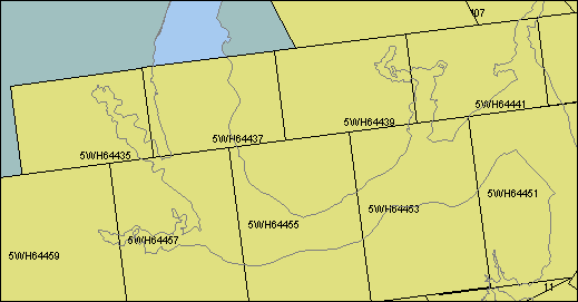
Upper Pautuxant, Calvert Cliffs
| Image ID | Comments | Year | Scale | Azimuth | Latitude | Longitude |
| 5WH64357 | | 1992 | 50000 | 162.1 | 38.364 | -76.511 |
| 5WH64387 | | 1992 | 50000 | 310.8 | 38.397 | -76.893 |
| 5WH64445 | | 1992 | 50000 | 150.0 | 38.447 | -76.848 |
| 5WH64447 | | 1992 | 50000 | 262.2 | 38.392 | -76.857 |
| 5WH64455 | | 1992 | 50000 | 262.6 | 38.353 | -77.230 |
| 5WH64457 | | 1992 | 50000 | 262.6 | 38.344 | -77.323 |
| 5WH64459 | | 1992 | 50000 | 262.6 | 38.334 | -77.416 |
| 5WJN1905 | | 1993 | 40800 | 172.0 | 38.626 | -76.529 |
| 5WJN1907 | | 1993 | 40700 | 171.9 | 38.559 | -76.517 |
| 5WJN1913 | | 1993 | 41100 | 352.7 | 38.431 | -76.646 |
| 5WJN1915 | | 1993 | 40900 | 351.2 | 38.498 | -76.657 |
| 5WJN1917 | | 1993 | 40800 | 350.7 | 38.569 | -76.669 |
| 5WJN1919 | | 1993 | 40600 | 350.6 | 38.632 | -76.680 |
| 5WJN1929 | | 1993 | 40300 | 156.5 | 38.586 | -76.528 |
| 5WJN1931 | | 1993 | 40500 | 155.6 | 38.525 | -76.495 |
| 5WJP1941 | | 1993 | 40000 | 138.8 | 38.544 | -76.693 |
| 5WJP1943 | | 1993 | 40000 | 139.0 | 38.496 | -76.639 |
| 5WJP1945 | | 1993 | 40000 | 139.5 | 38.446 | -76.584 |
| 5WJP1947 | | 1993 | 40000 | 138.0 | 38.397 | -76.529 |
St. Marys
| Image ID | Comments | Year | Scale | Azimuth | Latitude | Longitude |
| 5WH44341 | | 1992 | 50000 | 120.6 | 38.034 | -76.611 |
| 5WH44343 | | 1992 | 50000 | 120.0 | 37.997 | -76.530 |
| 5WH44345 | | 1992 | 50000 | 120.2 | 37.959 | -76.448 |
| 5WH64361 | Upper reaches of St. Mary's R. | 1992 | 50000 | 162.0 | 38.224 | -76.453 |
| 5WH64363 | | 1992 | 50000 | 161.7 | 38.154 | -76.424 |
| 5WH64365 | | 1992 | 50000 | 162.0 | 38.084 | -76.394 |
| 5WH64367 | | 1992 | 50000 | 351.5 | 38.030 | -76.350 |
| 5WH64369 | | 1992 | 50000 | 351.2 | 38.103 | -76.364 |
| 5WH64371 | | 1992 | 50000 | 351.3 | 38.177 | -76.378 |
| 5WH64373 | Cedar PT., coastline to S. | 1992 | 50000 | 351.5 | 38.250 | -76.392 |
| 5WH64377 | | 1992 | 50000 | 310.7 | 38.130 | -76.498 |
| 5WH64379 | | 1992 | 50000 | 310.5 | 38.183 | -76.577 |
| 5WH64381 | | 1992 | 50000 | 310.7 | 38.237 | -76.656 |
| 5WH64391 | | 1992 | 50000 | 123.3 | 38.156 | -76.713 |
| 5WH64393 | | 1992 | 50000 | 123.3 | 38.114 | -76.632 |
| 5WH64395 | | 1992 | 50000 | 122.9 | 38.072 | -76.551 |
| 5WH64419 | | 1992 | 50000 | 118.3 | 38.084 | -76.635 |
| 5WH64421 | | 1992 | 50000 | 118.6 | 38.046 | -76.543 |
| 5WH74485 | | 1992 | 20000 | 166.6 | 38.211 | -76.472 |
| 5WH74487 | | 1992 | 20000 | 166.9 | 38.180 | -76.463 |
| 5WH74489 | | 1992 | 20000 | 167.3 | 38.150 | -76.454 |
| 5WH74491 | | 1992 | 20000 | 167.1 | 38.119 | -76.444 |
| 5WH74493 | | 1992 | 20000 | 166.3 | 38.088 | -76.435 |
| 5WJP1939 | SE of Naval Air Station | 1993 | 40000 | 155.8 | 38.257 | -76.343 |
| 5WK46600 | Solomons | 1993 | 20000 | 347.0 | 38.099 | -76.424 |
| 5WK46602 | Pautuxant R. between NAS and Solomons | 1993 | 20000 | 354.5 | 38.129 | -76.434 |
| 5WK46604 | | 1993 | 20000 | 006.0 | 38.160 | -76.440 |
| 5WK46608 | St Marys R., Above St. Marys City | 1993 | 20000 | 357.7 | 38.217 | -76.443 |
| 5WK46610 | St Marys R., Windmill Pt. to Pagan Pt. (top is W) | 1993 | 20000 | 013.2 | 38.251 | -76.444 |
Potomac R. - Piney Pt. to Machodoc Cr.
| Image ID | Comments | Year | Scale | Azimuth | Latitude | Longitude |
| 5WH64379 | | 1992 | 50000 | 310.5 | 38.183 | -76.577 |
| 5WH64381 | | 1992 | 50000 | 310.7 | 38.237 | -76.656 |
| 5WH64383 | | 1992 | 50000 | 310.7 | 38.290 | -76.735 |
| 5WH64385 | | 1992 | 50000 | 310.6 | 38.344 | -76.814 |
| 5WH64387 | | 1992 | 50000 | 310.8 | 38.397 | -76.893 |
| 5WH64391 | | 1992 | 50000 | 123.3 | 38.156 | -76.713 |
| 5WH64393 | | 1992 | 50000 | 123.3 | 38.114 | -76.632 |
| 5WH64397 | | 1992 | 50000 | 317.3 | 38.201 | -76.750 |
| 5WH64399 | | 1992 | 50000 | 317.0 | 38.258 | -76.817 |
| 5WH64401 | | 1992 | 50000 | 317.0 | 38.314 | -76.884 |
| 5WH64403 | | 1992 | 50000 | 316.8 | 38.370 | -76.951 |
| 5WH64411 | | 1992 | 50000 | 118.0 | 38.240 | -77.003 |
| 5WH64413 | | 1992 | 50000 | 118.4 | 38.201 | -76.911 |
| 5WH64415 | | 1992 | 50000 | 118.3 | 38.162 | -76.819 |
| 5WH64417 | | 1992 | 50000 | 118.3 | 38.123 | -76.727 |
| 5WH64423 | | 1992 | 50000 | 332.1 | 38.150 | -76.926 |
| 5WH64425 | | 1992 | 50000 | 331.8 | 38.219 | -76.972 |
| 5WH64427 | | 1992 | 50000 | 332.1 | 38.287 | -77.019 |
| 5WH64447 | | 1992 | 50000 | 262.2 | 38.392 | -76.857 |
| 5WH64449 | | 1992 | 50000 | 262.2 | 38.382 | -76.950 |
| 5WH74461 | | 1992 | 20000 | 123.6 | 38.326 | -76.963 |
| 5WH74463 | | 1992 | 20000 | 124.7 | 38.306 | -76.925 |
| 5WH74465 | | 1992 | 20000 | 124.3 | 38.285 | -76.888 |
| 5WH74467 | | 1992 | 20000 | 124.7 | 38.265 | -76.849 |
| 5WH74469 | | 1992 | 20000 | 124.7 | 38.244 | -76.811 |
| 5WH74471 | | 1992 | 20000 | 124.0 | 38.224 | -76.774 |
| 5WH74473 | | 1992 | 20000 | 124.7 | 38.203 | -76.736 |
| 5WH74475 | | 1992 | 20000 | 330.1 | 38.220 | -76.673 |
| 5WH74477 | | 1992 | 20000 | 330.1 | 38.249 | -76.695 |
| 5WH74479 | | 1992 | 20000 | 330.2 | 38.278 | -76.716 |
| 5WH74481 | | 1992 | 20000 | 330.2 | 38.307 | -76.738 |
| 5WJN1909 | | 1993 | 40600 | 346.1 | 38.318 | -76.630 |
| 5WJN1911 | | 1993 | 41100 | 356.0 | 38.364 | -76.638 |
| 5WK46616 | | 1993 | 20000 | 228.1 | 38.304 | -76.606 |
| 5WK46618 | | 1993 | 20000 | 236.4 | 38.286 | -76.632 |
| 5WK46620 | | 1993 | 20000 | 242.5 | 38.267 | -76.661 |
| 5WK46622 | | 1993 | 20000 | 223.4 | 38.248 | -76.699 |
| 5WK46624 | | 1993 | 20000 | 225.9 | 38.228 | -76.726 |
Potomac R. - Mathias Pt. to Sandy Pt.
| Image ID | Comments | Year | Scale | Azimuth | Latitude | Longitude |
| 5WH44293 | | 1992 | 50000 | 310.2 | 38.247 | -77.278 |
| 5WH44295 | | 1992 | 50000 | 309.9 | 38.296 | -77.352 |
| 5WH64389 | | 1992 | 50000 | 310.8 | 38.450 | -76.972 |
| 5WH64405 | | 1992 | 50000 | 316.8 | 38.426 | -77.018 |
| 5WH64407 | | 1992 | 50000 | 316.6 | 38.483 | -77.085 |
| 5WH64409 | | 1992 | 50000 | 118.0 | 38.279 | -77.095 |
| 5WH64427 | | 1992 | 50000 | 332.1 | 38.287 | -77.019 |
| 5WH64429 | | 1992 | 50000 | 332.3 | 38.356 | -77.065 |
| 5WH64431 | | 1992 | 50000 | 332.0 | 38.424 | -77.111 |
| 5WH64433 | | 1992 | 50000 | 332.3 | 38.493 | -77.158 |
| 5WH64435 | | 1992 | 50000 | 082.5 | 38.395 | -77.360 |
| 5WH64437 | | 1992 | 50000 | 082.9 | 38.406 | -77.258 |
| 5WH64439 | | 1992 | 50000 | 082.9 | 38.416 | -77.155 |
| 5WH64441 | | 1992 | 50000 | 082.9 | 38.426 | -77.053 |
| 5WH64451 | | 1992 | 50000 | 262.6 | 38.373 | -77.043 |
| 5WH64453 | | 1992 | 50000 | 262.6 | 38.363 | -77.136 |
| 5WH64455 | | 1992 | 50000 | 262.6 | 38.353 | -77.230 |
| 5WH64457 | | 1992 | 50000 | 262.6 | 38.344 | -77.323 |
| 5WH64459 | | 1992 | 50000 | 262.6 | 38.334 | -77.416 |
Honga R., Fishing Bay, Nanticoke R.
| Image ID | Comments | Year | Scale | Azimuth | Latitude | Longitude |
| 5WK36373 | Little Choptank, Maddison Bay, Fishing Cr. | 1993 | 40000 | 192.1 | 38.470 | -76.201 |
| 5WK36375 | | 1993 | 40000 | 202.4 | 38.406 | -76.231 |
| 5WK36377 | Barren I. Gap, Honga R. | 1993 | 40000 | 213.8 | 38.351 | -76.261 |
| 5WK36417 | | 1993 | 40000 | 154.7 | 38.449 | -75.984 |
| 5WK36419 | | 1993 | 40000 | 151.1 | 38.388 | -75.949 |
| 5WK36421 | | 1993 | 40000 | 154.4 | 38.326 | -75.912 |
| 5WK36423 | Nanticoke Pt. | 1993 | 40000 | 158.8 | 38.263 | -75.870 |
| 5WK36445 | Nanticoke R. - Nanticoke Pt to Hains Pt., Chance | 1993 | 40000 | 338.0 | 38.236 | -75.934 |
| 5WK36447 | | 1993 | 40000 | 335.3 | 38.284 | -75.964 |
| 5WK36449 | | 1993 | 40000 | 341.5 | 38.336 | -75.996 |
| 5WK36451 | | 1993 | 40000 | 345.3 | 38.386 | -76.027 |
| 5WK36453 | | 1993 | 40000 | 327.2 | 38.440 | -76.051 |
| 5WK36462 | | 1993 | 40000 | 151.5 | 38.468 | -76.151 |
| 5WK36464 | | 1993 | 40000 | 158.9 | 38.411 | -76.114 |
| 5WK36466 | | 1993 | 40000 | 150.9 | 38.355 | -76.080 |
| 5WK36468 | | 1993 | 40000 | 162.5 | 38.303 | -76.042 |
| 5WK36470 | | 1993 | 40000 | 158.1 | 38.241 | -76.014 |
| 5WK36491 | | 1993 | 40000 | 335.8 | 38.220 | -76.071 |
| 5WK36493 | | 1993 | 40000 | 332.8 | 38.277 | -76.106 |
| 5WK36495 | | 1993 | 40000 | 327.3 | 38.332 | -76.140 |
| 5WK36497 | | 1993 | 40000 | 340.5 | 38.390 | -76.181 |
| 5WK36499 | | 1993 | 40000 | 331.1 | 38.438 | -76.204 |
| 5WK36511 | | 1993 | 40000 | 148.2 | 38.444 | -76.286 |
| 5WK36513 | | 1993 | 40000 | 150.2 | 38.395 | -76.255 |
| 5WK36515 | | 1993 | 40000 | 155.8 | 38.336 | -76.213 |
| 5WK36517 | | 1993 | 40000 | 157.0 | 38.284 | -76.182 |
| 5WK36519 | | 1993 | 40000 | 147.4 | 38.231 | -76.148 |
| 5WK46564 | | 1993 | 40000 | 050.6 | 38.228 | -75.852 |
| 5WK46585 | | 1993 | 40000 | 213.0 | 38.366 | -75.842 |
| 5WK46587 | | 1993 | 40000 | 206.0 | 38.308 | -75.876 |
| 5WK46589 | | 1993 | 40000 | 206.7 | 38.254 | -75.913 |
| 5WK46591 | | 1993 | 40000 | 203.3 | 38.195 | -75.949 |
| 5WL15978 | | 1994 | 24600 | 280.4 | 38.421 | -75.881 |
| 5WL15980 | | 1994 | 24700 | 280.9 | 38.426 | -75.922 |
| 5WL15982 | | 1994 | 24600 | 280.3 | 38.432 | -75.964 |
| 5WL15984 | | 1994 | 24300 | 279.9 | 38.438 | -76.004 |
| 5WL15986 | | 1994 | 24100 | 280.7 | 38.444 | -76.045 |
| 5WL15988 | | 1994 | 24000 | 278.9 | 38.450 | -76.084 |
| 5WL15990 | | 1994 | 24000 | 281.9 | 38.455 | -76.123 |
| 5WL15992 | | 1994 | 24000 | 280.0 | 38.461 | -76.162 |
| 5WL16004 | | 1994 | 24000 | 100.7 | 38.442 | -76.218 |
| 5WL16006 | | 1994 | 24100 | 102.4 | 38.434 | -76.169 |
| 5WL16008 | | 1994 | 24100 | 101.1 | 38.426 | -76.118 |
| 5WL16010 | | 1994 | 24000 | 100.5 | 38.418 | -76.068 |
| 5WL16012 | | 1994 | 24100 | 099.7 | 38.411 | -76.019 |
| 5WL16014 | | 1994 | 24300 | 100.8 | 38.404 | -75.969 |
| 5WL16016 | | 1994 | 24500 | 099.6 | 38.397 | -75.920 |
| 5WL16018 | | 1994 | 24600 | 101.8 | 38.391 | -75.870 |
| 5WL16026 | | 1994 | 24300 | 281.1 | 38.365 | -75.874 |
| 5WL16028 | | 1994 | 24200 | 281.6 | 38.372 | -75.922 |
| 5WL16030 | | 1994 | 24100 | 280.8 | 38.379 | -75.971 |
| 5WL16032 | | 1994 | 24100 | 280.0 | 38.386 | -76.020 |
| 5WL16034 | | 1994 | 24100 | 278.6 | 38.393 | -76.068 |
| 5WL16036 | | 1994 | 24100 | 280.4 | 38.400 | -76.117 |
| 5WL16038 | | 1994 | 24000 | 281.6 | 38.407 | -76.165 |
| 5WL16040 | | 1994 | 24000 | 279.6 | 38.414 | -76.212 |
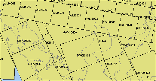
Deal Island Area
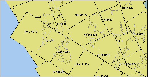
| Image ID | Comments | Year | Scale | Azimuth | Latitude | Longitude |
| 5WK36423 | | 1993 | 40000 | 158.8 | 38.263 | -75.870 |
| 5WK36425 | | 1993 | 40000 | 154.2 | 38.202 | -75.837 |
| 5WK36427 | | 1993 | 40000 | 147.2 | 38.140 | -75.799 |
| 5WK36429 | Upper reaches of Big Annemessex R., Colbourn Cr. | 1993 | 40000 | 139.9 | 38.082 | -75.764 |
| 5WK36437 | N. side of Pocomoke Sound | 1993 | 40000 | 330.4 | 38.017 | -75.798 |
| 5WK36439 | Big Annemessex R., Jones Cr. | 1993 | 40000 | 329.9 | 38.068 | -75.826 |
| 5WK36441 | | 1993 | 40000 | 332.5 | 38.123 | -75.867 |
| 5WK36443 | | 1993 | 40000 | 344.7 | 38.174 | -75.899 |
| 5WK36445 | | 1993 | 40000 | 338.0 | 38.236 | -75.934 |
| 5WK36470 | | 1993 | 40000 | 158.1 | 38.241 | -76.014 |
| 5WK36472 | | 1993 | 40000 | 155.6 | 38.185 | -75.974 |
| 5WK36474 | | 1993 | 40000 | 149.1 | 38.137 | -75.946 |
| 5WK36476 | Tangier Sound W. of Hazzard Pt. and Big Annemessex R. | 1993 | 40000 | 156.4 | 38.090 | -75.906 |
| 5WK36478 | N. of Crisfield | 1993 | 40000 | 156.9 | 38.030 | -75.875 |
| 5WK36485 | Tangier Sound - E. of Smith I. | 1993 | 40000 | 334.2 | 38.047 | -75.965 |
| 5WK36487 | S. Marsh I. | 1993 | 40000 | 338.2 | 38.108 | -76.004 |
| 5WK36489 | | 1993 | 40000 | 332.5 | 38.164 | -76.036 |
| 5WK36491 | | 1993 | 40000 | 335.8 | 38.220 | -76.071 |
| 5WK36493 | | 1993 | 40000 | 332.8 | 38.277 | -76.106 |
| 5WK36519 | | 1993 | 40000 | 147.4 | 38.231 | -76.148 |
| 5WK36521 | | 1993 | 40000 | 161.6 | 38.182 | -76.115 |
| 5WK36523 | | 1993 | 40000 | 146.0 | 38.110 | -76.082 |
| 5WK36525 | N. end of Smith I. | 1993 | 40000 | 145.1 | 38.049 | -76.041 |
| 5WK36527 | SW part of Smith I. | 1993 | 40000 | 147.4 | 37.997 | -76.002 |
| 5WK46548 | Smith I. | 1993 | 40000 | 349.6 | 37.991 | -76.019 |
| 5WK46550 | Kedges Straits | 1993 | 40000 | 353.3 | 38.064 | -76.033 |
| 5WK46552 | Big Annemessex R. mouth | 1993 | 40000 | 189.9 | 38.080 | -75.853 |
| 5WK46554 | Janes I., Crisfield | 1993 | 40000 | 183.8 | 38.016 | -75.863 |
| 5WK46564 | | 1993 | 40000 | 050.6 | 38.228 | -75.852 |
| 5WK46589 | | 1993 | 40000 | 206.7 | 38.254 | -75.913 |
| 5WK46591 | | 1993 | 40000 | 203.3 | 38.195 | -75.949 |
| 5WK46593 | | 1993 | 40000 | 201.5 | 38.135 | -75.983 |
| 5WK46595 | Kedges Straits (E at top) | 1993 | 40000 | 211.1 | 38.069 | -76.018 |
| 5WK46597 | Smith I., Ewell | 1993 | 40000 | 195.6 | 38.011 | -76.051 |
| 5WL15943 | Crisfield, Janes I. (E at top) | 1994 | 53600 | 299.9 | 37.996 | -75.827 |
| 5WL15962 | Crisfield, Janes I. (E at top) | 1994 | 34900 | 303.4 | 38.010 | -75.856 |
| 5WL15964 | Tangier Sound - W. ofCrisfield | 1994 | 34800 | 303.1 | 38.038 | -75.914 |
| 5WL15966 | Tangier Sound SW of S. Marsh I. (top is SE) | 1994 | 34600 | 302.0 | 38.067 | -75.970 |
Smith I., Chrsfield area
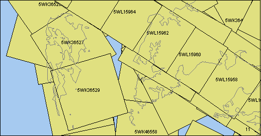
| Image ID | Comments | Year | Scale | Azimuth | Latitude | Longitude |
| 5WK36429 | Upper reaches of Big Annemessex R., Colbourn Cr. | 1993 | 40000 | 139.9 | 38.082 | -75.764 |
| 5WK36431 | N. side of Pocomoke Sound, East Cr., Marumasco Cr. | 1993 | 40000 | 157.1 | 38.027 | -75.720 |
| 5WK36433 | Pocomoke Sound, Messongo Cr. | 1993 | 40000 | 159.9 | 37.964 | -75.684 |
| 5WK36437 | N. side of Pocomoke Sound | 1993 | 40000 | 330.4 | 38.017 | -75.798 |
| 5WK36439 | Big Annemessex R., Jones Cr. | 1993 | 40000 | 329.9 | 38.068 | -75.826 |
| 5WK36476 | Tangier Sound W. of Hazzard Pt. and Big Annemessex R. | 1993 | 40000 | 156.4 | 38.090 | -75.906 |
| 5WK36478 | N. of Crisfield | 1993 | 40000 | 156.9 | 38.030 | -75.875 |
| 5WK36480 | Crisfield | 1993 | 40000 | 148.3 | 37.977 | -75.847 |
| 5WK36482 | S. of Crisfield | 1993 | 40000 | 153.7 | 37.930 | -75.814 |
| 5WK36485 | Tangier Sound - E. of Smith I. | 1993 | 40000 | 334.2 | 38.047 | -75.965 |
| 5WK36487 | S. Marsh I. | 1993 | 40000 | 338.2 | 38.108 | -76.004 |
| 5WK36525 | N. end of Smith I. | 1993 | 40000 | 145.1 | 38.049 | -76.041 |
| 5WK36527 | SW part of Smith I. | 1993 | 40000 | 147.4 | 37.997 | -76.002 |
| 5WK36529 | S. of Smilth I. | 1993 | 40000 | 163.2 | 37.932 | -75.974 |
| 5WK46544 | Tangier I. | 1993 | 40000 | 353.5 | 37.853 | -75.980 |
| 5WK46546 | S. end of Smith I. | 1993 | 40000 | 348.2 | 37.921 | -75.995 |
| 5WK46548 | Smith I. | 1993 | 40000 | 349.6 | 37.991 | -76.019 |
| 5WK46550 | Kedges Straits | 1993 | 40000 | 353.3 | 38.064 | -76.033 |
| 5WK46552 | Big Annemessex R. mouth | 1993 | 40000 | 189.9 | 38.080 | -75.853 |
| 5WK46554 | Janes I., Crisfield | 1993 | 40000 | 183.8 | 38.016 | -75.863 |
| 5WK46556 | S. of Crisfield (E at top) | 1993 | 40000 | 190.1 | 37.948 | -75.870 |
| 5WK46558 | Mouth of Pocomoke Sound | 1993 | 40000 | 186.8 | 37.875 | -75.875 |
| 5WK46595 | Kedges Straits (E at top) | 1993 | 40000 | 211.1 | 38.069 | -76.018 |
| 5WK46597 | Smith I., Ewell | 1993 | 40000 | 195.6 | 38.011 | -76.051 |
| 5WL05813 | Upper Pocomoke Sound, N. End Pt., Messongo Cr. | 1994 | 47100 | 206.1 | 37.951 | -75.690 |
| 5WL05817 | Pocomoke Sound S. of Crisfield, The Notch | 1994 | 46900 | 206.7 | 37.827 | -75.768 |
| 5WL15939 | Upper Pocomoke Sound, N. End Pt., Messongo Cr. (E at top) | 1994 | 53500 | 301.0 | 37.929 | -75.691 |
| 5WL15941 | E. of Crisfield, Pocomoke Sound, N. End Pt. (E at top) | 1994 | 53600 | 303.7 | 37.963 | -75.759 |
| 5WL15943 | Crisfield, Janes I. (E at top) | 1994 | 53600 | 299.9 | 37.996 | -75.827 |
| 5WL15956 | Pocomoke Sound, N. End Pt., Messongo Cr., Saxis (E at top) | 1994 | 34700 | 303.2 | 37.918 | -75.681 |
| 5WL15958 | Pocomoke Sound, N. End Pt., Saxis (E at top) | 1994 | 34600 | 304.7 | 37.946 | -75.737 |
| 5WL15960 | Pocomoke Sound,E. of Crisfield (E at top) | 1994 | 34800 | 302.5 | 37.981 | -75.800 |
| 5WL15962 | Crisfield, Janes I. (E at top) | 1994 | 34900 | 303.4 | 38.010 | -75.856 |
| 5WL15964 | Tangier Sound - W. ofCrisfield | 1994 | 34800 | 303.1 | 38.038 | -75.914 |
| 5WL15966 | Tangier Sound SW of S. Marsh I. (top is SE) | 1994 | 34600 | 302.0 | 38.067 | -75.970 |
| 5WL15968 | S. Marsh I. (top is SE) | 1994 | 34500 | 301.9 | 38.096 | -76.027 |
|
|